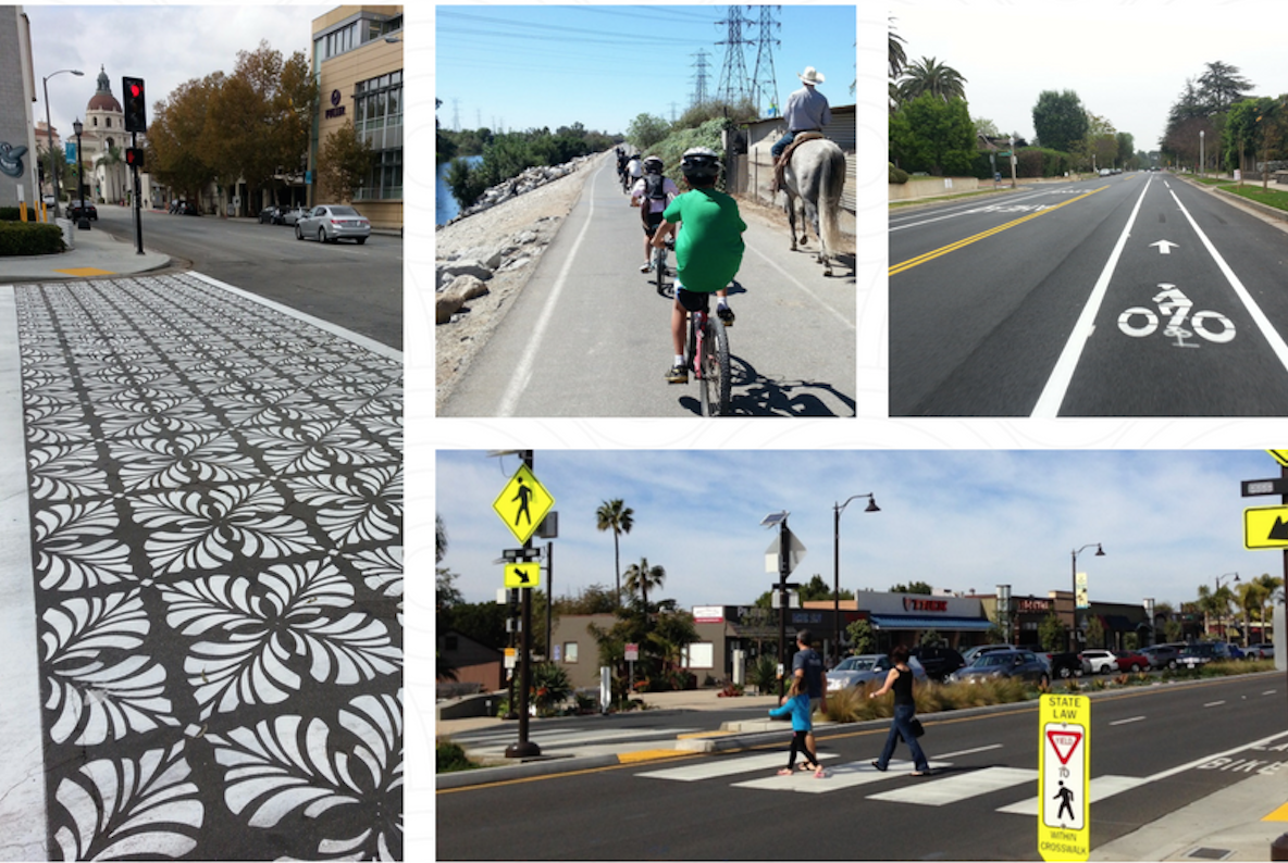
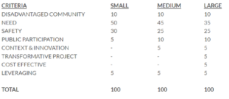
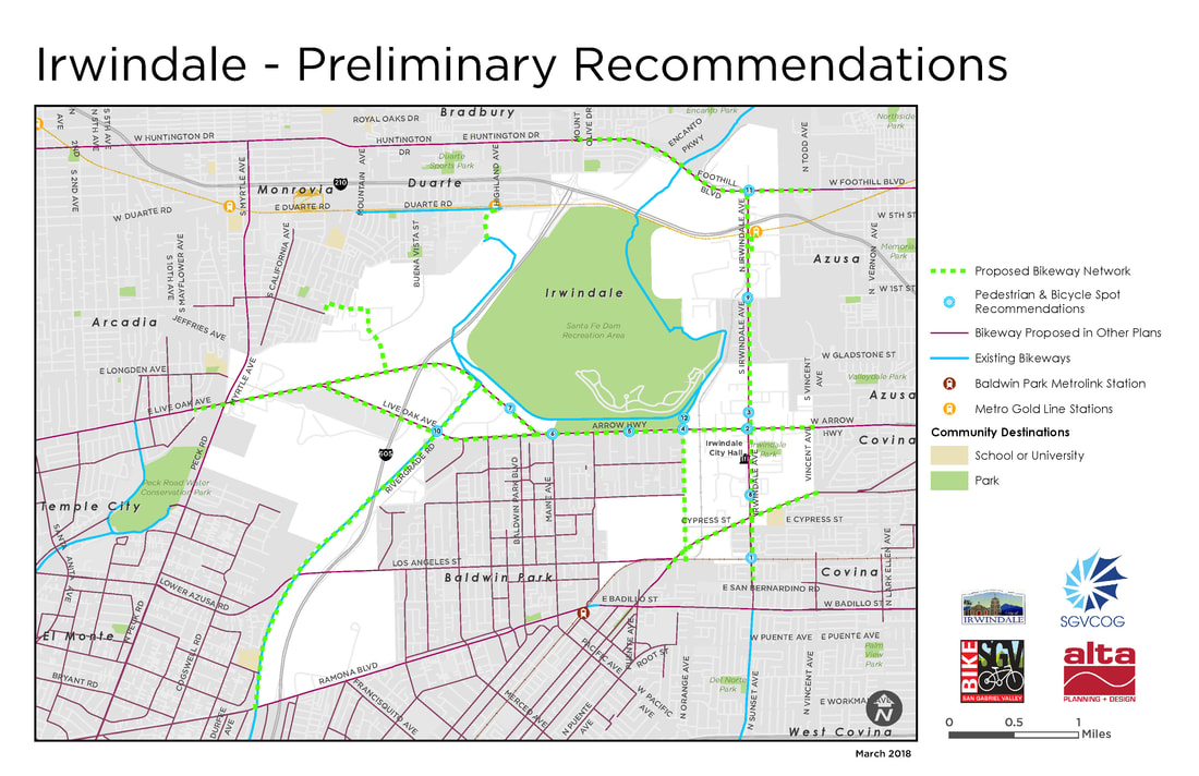
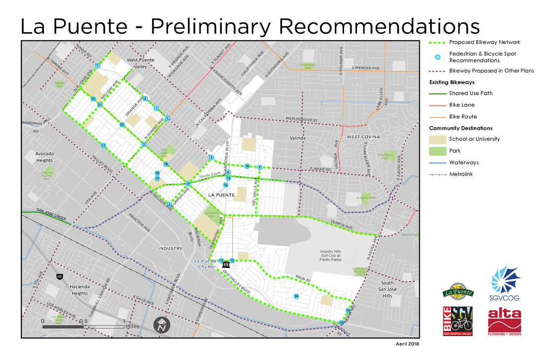
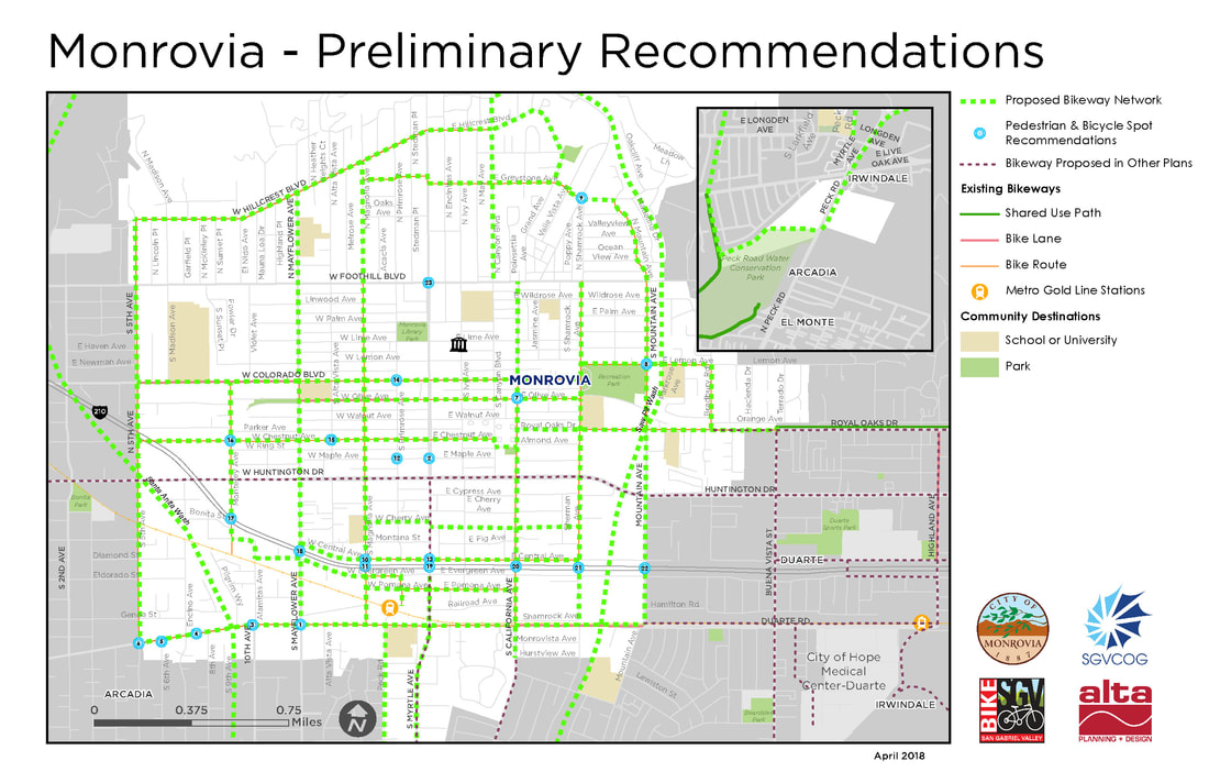
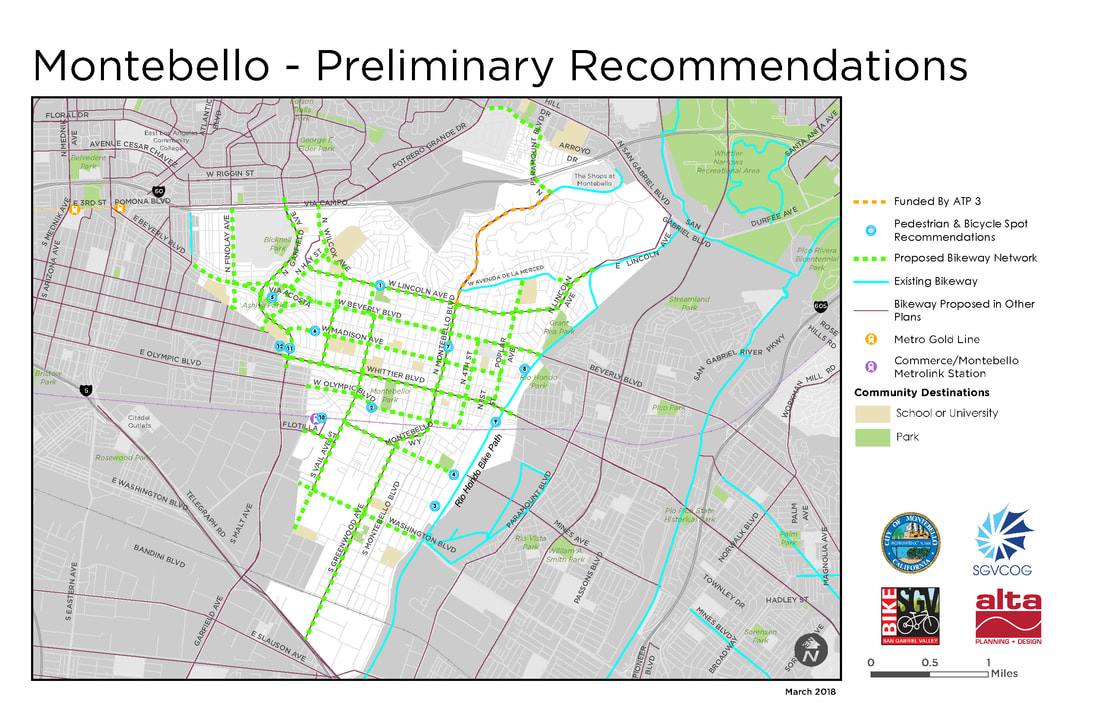
 Sample improvements, clockwise from left to right: High visibility, artistic crosswalk; 'Greenway' multi-use path' Class II Bicycle Lane'; Rapid Rectangular Flash Beacon (RRFB), Pedestrian Safety Island, and High-Visibility Crosswalk Informed by the input received by 748 community survey respondents, 11 public input booths (at least 2 per community), 5 community street audits, and 2 greenway exploratory audits, the #ActiveSGV project team has developed the following draft pedestrian and bicycle plans. Now is YOUR opportunity to review the drafts and provide additional suggestions, recommendations, and feedback. Draft plan maps for the 5 project cities (Glendora, La Puente, Irwindale, Monrovia and Montebello) as well as the SGV Greenways Feasibility Study can be found below. If you would like a high-quality version of any of the maps below, you can download them here. Please take a few minutes to view the maps and recommendations you're most interested in, and then submit this online form if you have any additional feedback. Input deadline is May 31, 2018. Thank you in advance for your time and consideration! 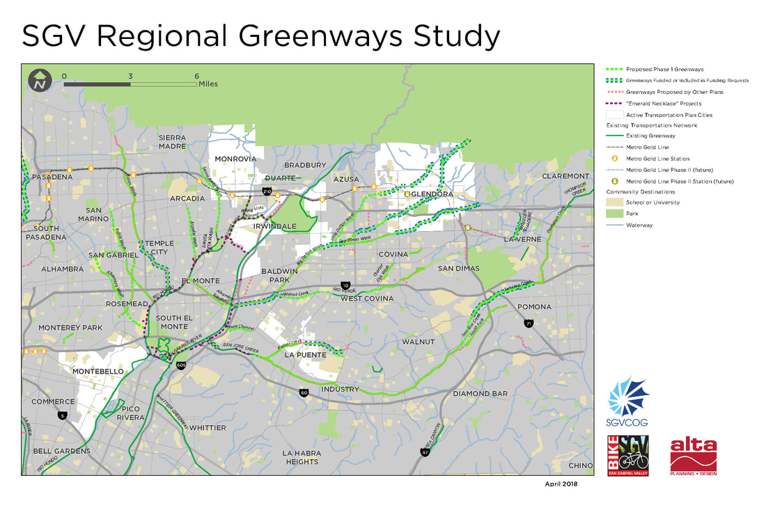 SGV greenways prioritization started with a review of almost 900 miles of Waterway, Utility, Rail, and old Red Car Line alignments. This was reduced to about 220 miles by removing highly constrained corridors and existing segments, and then further reduced to 72 miles by focusing on projects that have undergone previous planning. Analysis methodology generally followed the CA-Active Transportation Program (ATP) scoring:
 CA-ATP (Cycle 4) Scoring Methodology  Walnut Trail, Edison Right-of-Way, Irvine, CA Walnut Trail, Edison Right-of-Way, Irvine, CA Waterways Alhambra Wash: 4.2 Miles Cities: Industry (0.5 miles), El Monte (2 miles), San Gabriel (1.5 Miles) The northern end of this corridor is Mission Rd, between San Gabriel High School and Alhambra Golf Course, where a potential connection exists to a proposed greenway along the rail corridor. Moving southward, the corridor passes Vincent Lugo Park then uses an on-street connection across Valley Blvd, then continues along the channel past Del Mar Blvd. The southern end is at the Whittier Narrows Golf Course and Rio Hondo Bike Path. Several undercrossings, including I-10, and a narrow channel make this route challenging. Arcadia Wash: 2.5 Miles Cities: Arcadia (1.3 Miles), El Monte (0.2 Miles), Temple City (0.9 Miles) This corridor begins near Arcadia High School at the north, then heads south to cross existing bike lanes on El Monte Ave. From there it runs parallel to El Monte Ave until its terminus at the Rio Hondo Bike Path. Bassett Channel: 1.3 Miles Cities: City of Industry (0.3 Miles), Unincorporated (1 Mile) From east to west, the corridor follows Workman Mill Rd near Valley Blvd to the San Gabriel River Trail. It must cross I-605 to make the connection to the San Gabriel River on the west, which would require a major undercrossing. The corridor would otherwise end at Packam Dr. Bike lanes on Workman Mill Rd provide an alternate connection via San Jose Creek. Big Dalton Wash: 4 Miles Cities: Baldwin Park (1.9 Miles), Covina (0.4 Miles), Irwindale (0.7 Miles), Unincorporated (0.9 Miles), West Covina (0.3 Miles) This corridor fills in missing gaps in Big Dalton Wash, adding onto previously-funded portions in Glendora, Azusa, and Unincorporated areas. It begins at Barranca Ave at the northeast, and travels southwest to the I-10 where it meets Walnut Creek. The portion of Walnut Creek from this confluence to the San Gabriel River has been previously funded. Buena Vista Channel: 1.8 Miles Cities: Irwindale (1.8 Miles) This corridor begins on the east at the new trail connecting the San Gabriel River path and Duarte Gold Line Station. It follows the channel west to Sawpit Wash. Charter Oak Wash: 1.5 Miles Cities: Covina (1.5 Miles) While this corridor is entirely within the City of Covina, it is in two main segments. At the north it connects from E Cypress St to an existing path in Kahler Russell Park. An on-street connection south on Grand Ave then west on E Badillo St, rejoining the channel and traveling south through residential neighborhoods, crossing E Puente St and E Rowland St to reach E Workman Ave. Eaton Wash: 4.6 Miles Cities: Pasadena (2.1 Miles), Temple City (0.6 Miles), Unincorporated (1.8 Miles) Filling out the northern reach of Eaton Wash, this corridor begins at E Washington Blvd and Woodlyn Rd at the north, running parallel to the utility corridor, south past I-210, where an on-street connection may be needed. The southern terminus is Muscatel Ave, where another planned segment is underway. Little Dalton Wash: 3.3 Miles Cities: Azusa (2 Miles), Unincorporated (1.2 Miles) Beginning at the city limits of Glendora at the north, at Citrus College, Little Dalton Wash moves southwest through Azusa and Unincorporated areas. It passes just north of Azusa High School before intersecting I-210, where the channel will either need to be modified for an undercrossing or an on-street connection will need to be used. The corridor passes three more schools before terminating at the confluence with Big Dalton Wash. Portions within Glendora have already received funding and are excluded from this study. Puente Creek: 2.2 Miles Cities: City of Industry (0.7 Miles), La Puente (0.8 Miles), Unincorporated (0.7 Miles) This corridor begins just west of the shopping center at S Hacienda Blvd and Amar Rd in La Puente. Moving southwest it passes Sparks Middle and Elementary Schools, and crosses a set of railroad tracks between Proctor Rd and Don Julian Rd before meeting San Jose Creek. Rubio Wash: 4.7 Miles Cities: El Monte (0.1 Miles), Rosemead (2.0 Miles), San Gabriel (1.7 Miles), San Marino (0.7 Miles), South El Monte (0.1 Miles), Unincorporated (0.2 Miles) This corridor begins at San Marino High School in the north, and moving south, crosses Huntington Blvd and San Gabriel Country Club. Portions of the channel are blocked with parking lots near Valley Blvd and S Walnut Grove Ave. The channel crosses under I-10 before meeting the west bank of the Rio Hondo. San Dimas Wash: 2.7 Miles Cities: Covina (2.1 Miles), Glendora (0.3 Miles), Unincorporated (0.3 Miles) Closing a gap between a funded portion in Glendora and its confluence with Big Dalton Wash, this corridor follows an existing maintenance road and connects to Hollenbeck Park. San Jose Creek: 16.8 Miles Cities: City of Industry (9.5 Miles), Pomona (5.1 Miles), Unincorporated (2.2 Miles) The longest overall corridor in this study, San Jose Creek largely parallels SR 60 and Metrolink rail. The northeasternmost point connects to Ganesha Park in Pomona, and would require a new underpass or an on-street connection to move south of I-10. The corridor passes several parks and schools before crossing under SR 71 and SR 57, running alongside Cal Poly Pomona before entering City of Industry. A portion at the western end, within City of Industry has received funding, and an unincorporated segment at the furthest west point connects to the San Gabriel River. San Jose Creek – South Fork: 2.6 Miles Cities: Pomona (2.6 Miles) This corridor runs from Veterans Park soccer complex in Pomona, southwest to baseball fields in Diamond Bar, crossing industrial and agricultural areas. Santa Anita Wash: 3.2 Miles Cities: Arcadia (2 Miles), Monrovia (0.8 Miles), Unincorporated (0.4 Miles) Beginning at E Sycamore Ave at the north, near Foothills Middle School, the corridor passes Eisenhower Park before crossing under I-210. Heading south, it crosses relatively few streets before reaching the Rio Hondo Bike Path in Arcadia, at E Live Oak Ave. Sawpit Wash: 2.2 Miles Cities: Irwindale (0.8 Miles), Monrovia (0.4 Miles), Unincorporated (0.9 Miles) This corridor begins in the north at E Duarte Rd near Maxwell Elementary School. It follows the channel south, joining with Buena Vista Channel, terminating at Peck Rd. A connection from the end of Sawpit Wash to the Rio Hondo Bike Path would be made at Peck Rd Park. Thompson Creek: 3 Miles Cities: Claremont (0.6 Miles), Pomona (2.4 Miles) Near Sumner Elementary School in Claremont, the corridor follows existing maintenance roads adjacent to the channel south to Bonita Ave, where it runs parallel to Fulton Rd until reaching the Pomona Fairplex. The southern terminus of the channel can connect to San Jose Creek at Ganesha Park. Walnut Creek: 5.2 Miles Cities: Covina (1.2 Miles), Unincorporated (0.4 Miles), West Covina (3.6 Miles) This corridor’s easternmost point, on N Reeder Ave, south of Badillo Elementary School in Covina, follows a naturalized creek through a neighborhood with limited access. An alternative easternmost point would be at E Covina Hills Rd, where an existing maintenance road follows the channel to I-10, where an undercrossing or on-street connection would be needed. South of I-10, the corridor follows the channel west to meet a previously-funded project in Baldwin Park at Big Dalton Wash. Rail Corridors Alhambra Subdivision (Amtrak Parallel): 4 Miles Cities: City of Industry (0.5 Miles), El Monte (2 Miles), San Gabriel (1.5 Miles) An east-west connection between the Rio Hondo and San Gabriel River Bike Paths is created by this rail corridor in the City of Industry and El Monte. Madrid Middle School lies at the eastern end. Overall the right of way is sufficient to create a trail parallel to existing rail lines, though a crossing at Garvey Ave may require an on-street connection or a new bridge. The portion of the corridor in San Gabriel creates and east-west connection between Alhambra Wash and Rubio Wash, two other proposed greenways. Utility Corridors Edison Right of Way (ROW): Monterey Park, 0.7 Miles Meeting the existing Edison Trails Mark in Monterey Park, this connection runs west then south, terminating at W Floral Dr between Hendricks Ave and Findlay Ave. This trail would require negotiations with existing nursery operations within the utility corridor. Edison ROW: Rosemead, 3 Miles This utility corridor spans nearly the entire San Gabriel Valley north-to-south, and crosses several other potential greenways. The portion under study here, in Rosemead, begins at Grand Ave in the north, crosses I-10, and ends at Graves Ave. Nurseries are currently using portions of the corridor, while other portions are open. Zapopan Park falls in the middle of the corridor. Edison ROW: South Pasadena, 1.3 Miles This corridor runs from Grevelia St and Garfield Park at the north, to W Alhambra Rd and Alhambra Park at the south, with a gap in the middle at South Pasadena Middle School. It passes primarily through residential neighborhoods, and is currently clear of existing uses beyond a maintenance road. 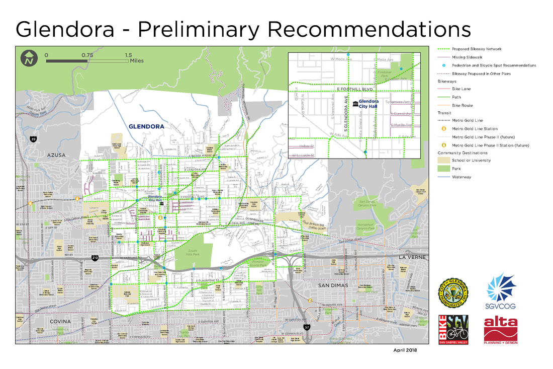 Spot Recommendations (based on community input and feedback)
 Spot Recommendations (based on community input and feedback)
 Spot Recommendations (based on community input and feedback)
 Spot Recommendations (based on community input and feedback)
 Spot Recommendations (based on community input and feedback)
2 Comments
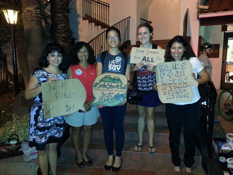
 Help us make walking and biking in the San Gabriel Valley safer and more enjoyable! Join us at an upcoming community event to see the SGV Regional Plan's draft recommendations and share your feedback on potential roadway and sidewalk improvements. See below for details.
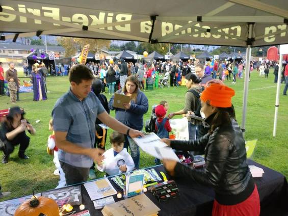
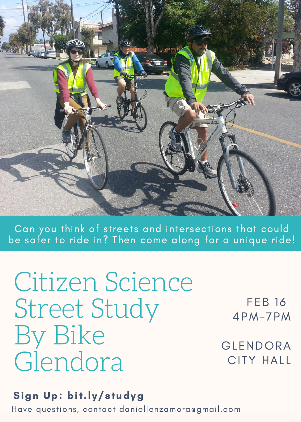
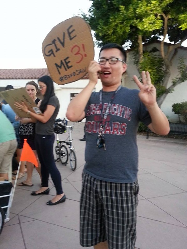
Sunday 3/31 10am-12pm Irwindale Eggstravaganza Dan Diaz Rec Center 16053 Calle De Paseo bit.ly/2FQU35s Sunday 3/31 10:30am-2:30pm Montebello Easter Egg Hunt Montebello City Park in the Baseball Field 1301 W. Whittier Blvd. http://bit.ly/2pfAidr Friday 4/13 5pm-9pm Monrovia Street Fair Myrtle Avenue in Old Town http://bit.ly/2tNnqke Saturday 4/14 10am-1pm La Puente Health, Wellness, and Safety Fair Sierra Vista Middle School 15801 Sierra Vista Ct, La Puente, CA 91744 http://bit.ly/2FCqvJH Saturday 4/21 9am-1pm Glendora Earth Day Festival Glendora City Hall 116 E Foothill Blvd. http://bit.ly/2IsLOea Can't make any of these events? Stay tuned for an upcoming post with draft maps and details on how to submit suggestions and feedback electronically. Help shape the SGV Pedestrian and Bicycle Master Plan by joining us for a community street study. We will be cruising or walking through each city to collect data on existing conditions for walking and biking, and provide feedback on potential safety improvements. Sign up for a street audit by clicking on the links below!
 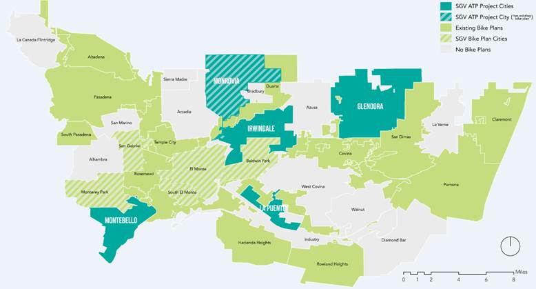 BikeSGV is VERY excited to report that an ambitious new regional active transportation planning effort has just kicked off in the San Gabriel Valley! Designed to build upon the successful 5-City SGV Regional Bicycle Master Plan unanimously adopted by the Cities of Monterey Park, Baldwin Park, El Monte, South El Monte and San Gabriel in 2014, the follow-up effort will provide local "Active Transportation Plans" (i.e. biking AND walking plans) to five SGV communities currently without: the Cities of Montebello, La Puente, Irwindale, Glendora and Monrovia. Equally exciting, the regional effort (hereafter Phase 2) will also include a Greenway Feasibility Study to identify the 50 miles of storm channels best suited for short-term greenway development! ActiveSGV: Get Involved Timeline for Phase 2 is expected to run through October 2018, with community engagement in the process strongly encouraged! One easy way to do so is to take the plan community input survey, available online here. If you'd like to sign-up to volunteer for this ambitious new regional project, please let us know here; volunteers are needed to assist with local Bicycle and Pedestrian Counts, community street audits on foot and bike, and community meetings over the next 12 months. 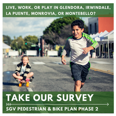 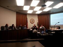 South El Monte Council reviews final plan South El Monte Council reviews final plan On December 15th the South El Monte City Council became the 5th and final project City to formally adopt their city-section of the San Gabriel Valley Regional Bicycle Master Plan! The Council's unanimous vote in favor of the plan left the project with a perfect, 25-0 record by local leaders.
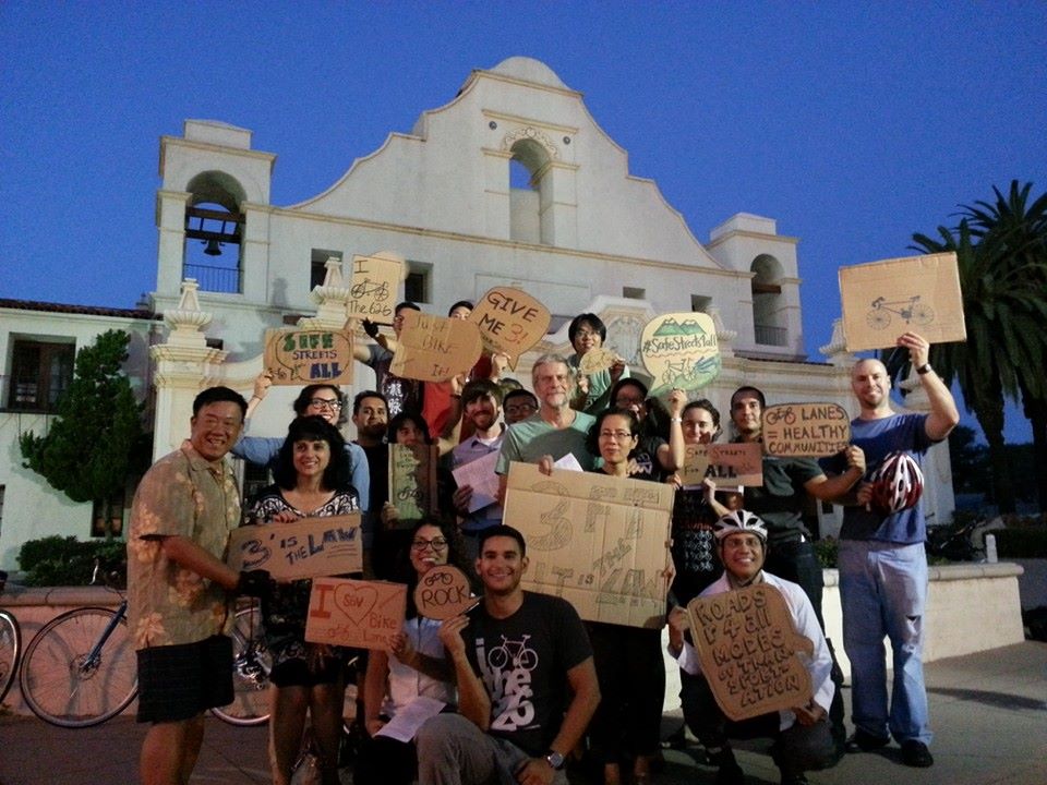
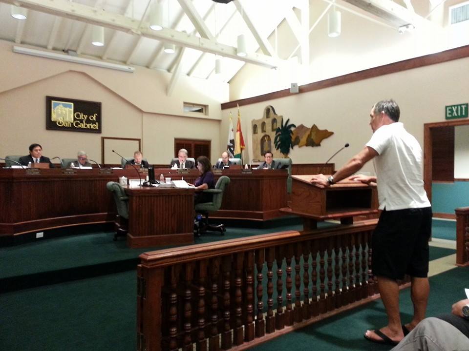
A huge thank you to all the members of the public, city staff, public health professionals and other supporters who shepherded this project from an idea in 2010 to a funded project and finally an adopted plan. Although project funding for this effort was cut short by the US Congress, ending prematurely in September 2014, we are confident the final plan's many supporters will help ensure that implementation moves forward even without dedicated staff to assist the 5 project cities. However, that will only be possible if local residents like you continue to stay active and support the development of safer, more bicycle and pedestrian friendly streets! Stay tuned and stay involved! On November 25th, 2014, the City of El Monte unanimously passed several key items significant to advancing community health, including a local Complete Streets policy and the El Monte Bike Plan portion of the regional plan! On hand to celebrate this auspicious moment and provide comment to local leaders were the Day One El Monte team of staff and Youth Advocates, as well as 30-40 community residents from El Monte and the greater San Gabriel Valley! With glow bracelets, Christmas lights, bright reflective tape and neon signs, the group demonstrated the importance of visibility for pedestrians and bikers. 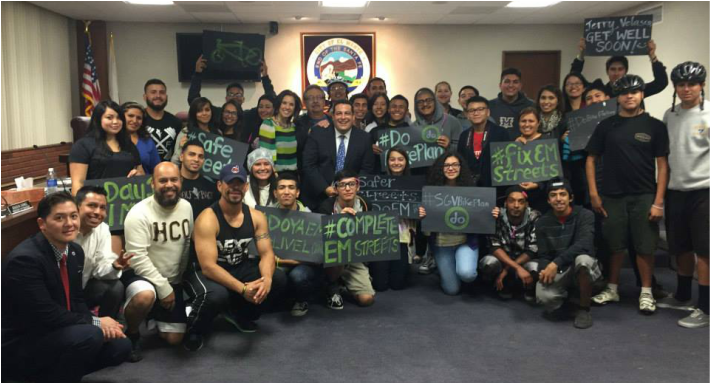 El Monte Mayor and City Council with Day One El Monte Youth Advocates, staff and bike plan supporters after passing Complete Streets policy and Bike Plan To underline the need for streets that accommodate all road users, the DO youth advocates also put together and screened a video highlighting why "Complete Streets" were important to them. With the passage of both policies the City of El Monte is one step closer to becoming a more bike-and-pedestrian friendly community. We extend a huge thank you to all those who made this possible, particularly Councilwoman Victoria Martinez, Mountain View High School, El Monte/South El Monte Chamber of Commerce, El Monte Union High School Board, First 5 LA/Best Start- El Monte/South El Monte, Wolfpack Fitness, South El Monte Arts Posse, and many more! 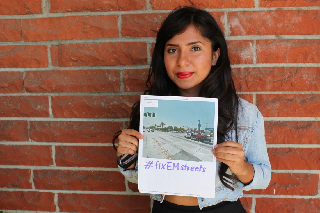 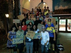 Supporters post-vote! Supporters post-vote! In a 5-0 vote, the San Gabriel City Council became the first of the five SGV Bike Plan project cities to formally adopt their city-level plan on Tuesday September 16, the same day the state of California's new 3-foot safe passing law went into effect. Over 30 local residents and plan supporters attended the meeting, the vast majority of whom stuck until well after 9pm, when the item was finally heard by the Council. Following a staff report outlining the plan and process to date (e.g., previous 5-0 City Planning Commission vote in favor of adoption), the floor was opened up to members of the public. Speakers included San Gabriel locals Manuel Mabra and John Saliamonas, public health advocate and resident Scott Chan of the Asian Pacific Islander Obesity Prevention Alliance, San Gabriel School Board Member Denise Menchaca, Alhambra resident Michael Lawrence, Project Manager Javier Hernandez, and Eastside Bike Club founder and President Carlos Morales. The meeting was then turned over for Council discussion. Council Member Julie Costanzo, in underlining her support for the plan, shared that a cousin who did everything right as a cyclist (i.e., proper gear, riding technique) was killed by a motorist and that the City can and should do more to make its streets safer for people on bikes, especially children. Council Member Sawkins echoed safety concerns, and noted he would support the addition of Class II Bike Lanes to San Gabriel Blvd., if feasible. Mayor John Harrington, a father of two girls, told those in attendance of his experiences riding with his family in the City. A strong supporter of the plan, he noted that San Gabriel should be a City where "we can hop on the bike with the kids and be safe". The Mayor also shared that "If you fail to plan, you plan to fail." Council Member Chin Ho Liao thanked SGV Bike Plan Project Manager Javier Hernandez and city staff for all their hard work in developing the plan to date, and urged the City to continue to partner with BikeSGV and Day One on future grants to help fund plan implementation. Vice Mayor Jason Pu closed out the comments by motioning to adopt the plan. After being seconded by Council Member Costanzo, the final vote was unanimous in favor, with the additional direction to staff to study the potential for adding Class II Bike Lanes to San Gabriel Blvd., an improvement not listed in the draft plan. Many thanks to everyone who contributed to tonight's result and helped make the SGV Bike Master Plan project possible, including the consulting team at Alta Planning and the Day One and BikeSGV teams who dedicated countless hours to shepherding the vision for a regional bike plan in the San Gabriel Valley from concept to reality!
Over the past year Day One staff and BikeSGV volunteers have worked hand-in-hand with 5 cities - Monterey Park, San Gabriel, Baldwin Park, El Monte and South El Monte - to develop the San Gabriel Valley's first regional bicycle master plan. Designed to encourage healthier, more active lifestyles by creating an interconnected bicycle network that is safe and easily accessible for people of all ages and abilities, the plan is currently being reviewed by local residents, stakeholders and decision-makers. Please take a moment review the below maps and share any comments here. El Monte, South El Monte Bikeway Recommendations Map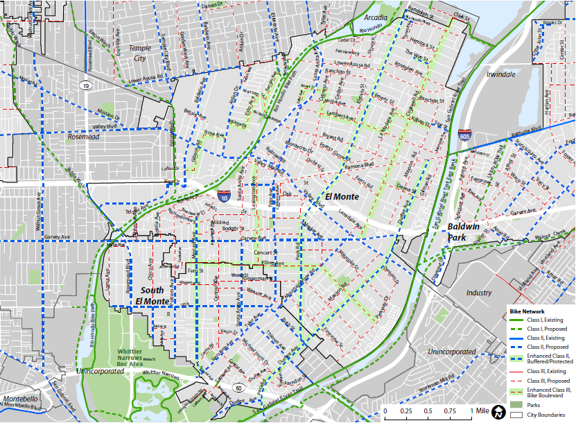
Baldwin Park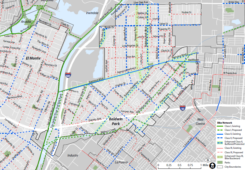
Monterey Park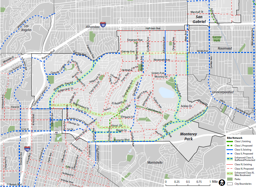
San Gabriel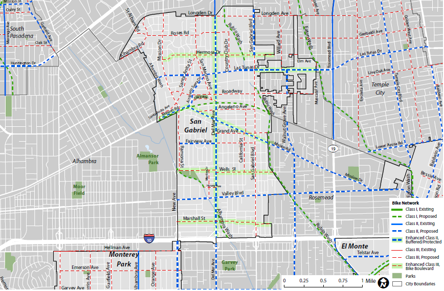
Download draft bikeway maps
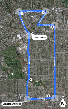 On Saturday April 12th a group of SGV Bike Plan volunteers, San Gabriel City staff, and project staff headed out to conduct a "Community Street Audit" of sections of 8 local streets. Why? Community Street Audits are a great way to evaluate the quality of local streets from the viewpoint of the people who use them. Street audits are typically conducted by walking or biking a 4 to 6-mile predetermined route with a small group of 6-10 people consisting of residents, stakeholders, elected officials, city staff, and/or technical consultants among others. The purpose of a community street audit is to help:
A huge thanks to all those who participated in the San Gabriel street audit! |
Archives
May 2018
Categories |
|||||||
 RSS Feed
